
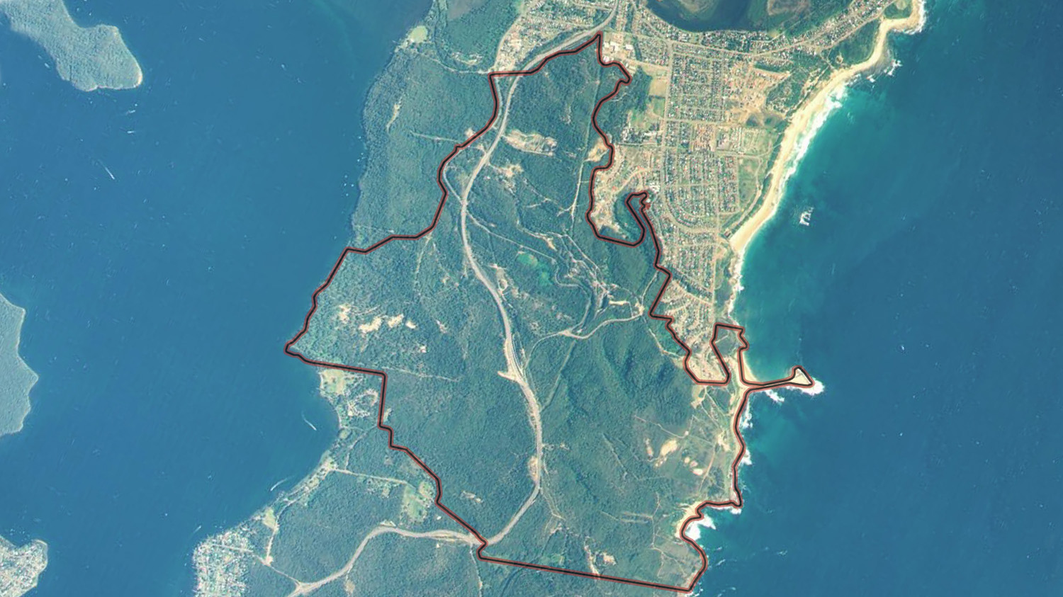
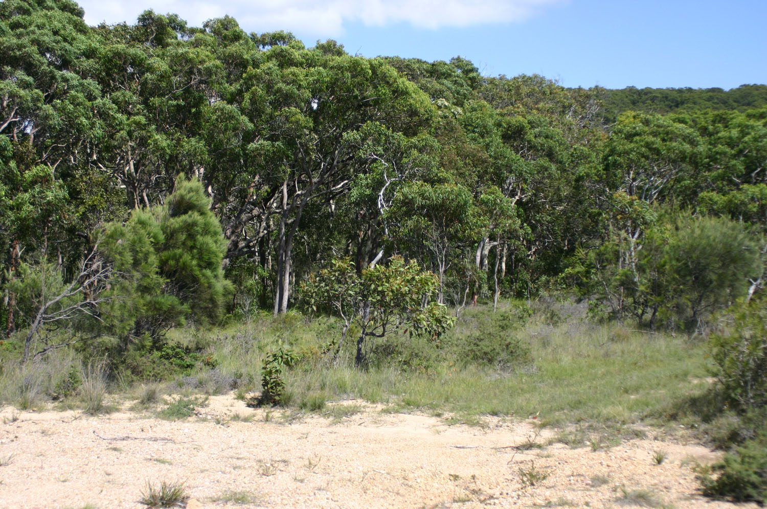
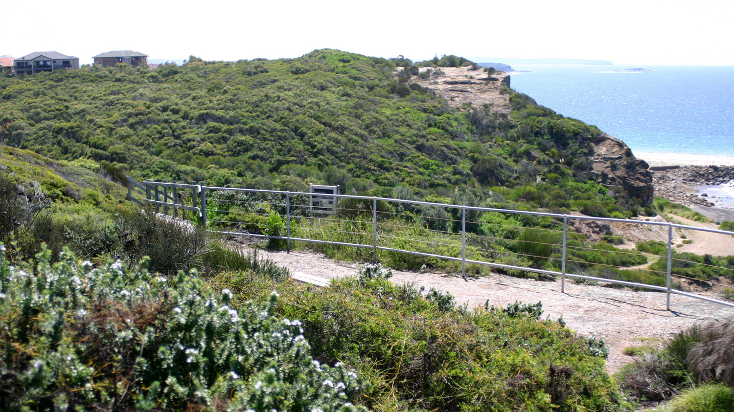
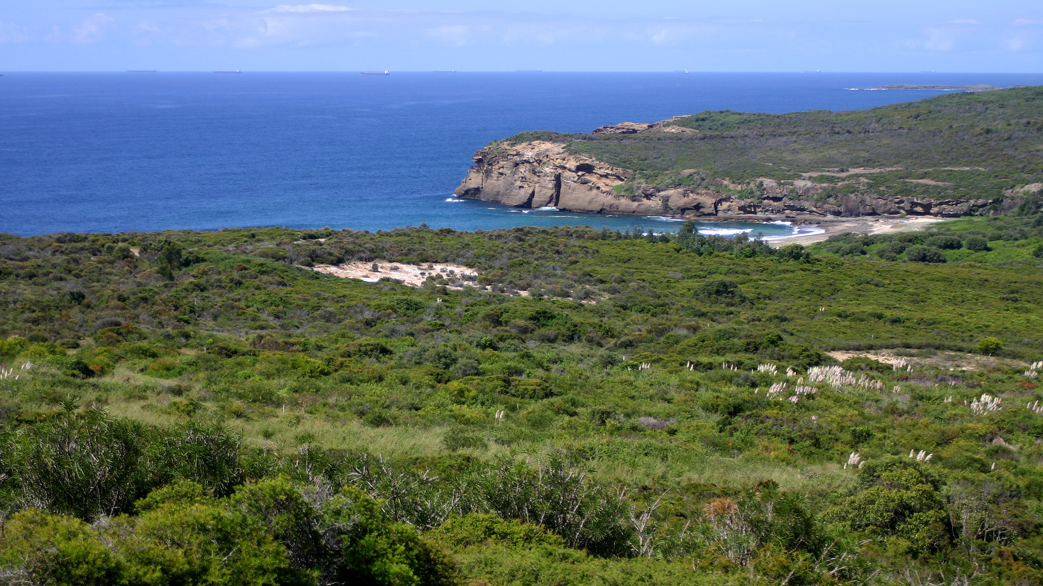
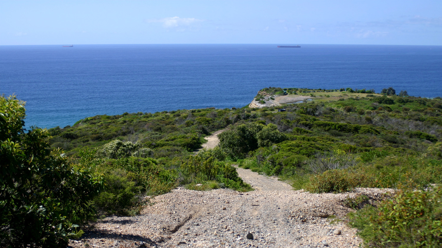
North Wallarah Peninsula located immediately south of Swansea incorporates a unique combination of landscape types that include rugged section of coastline with native heath, a forest-covered central ridgeline and slopes containing moist palm gullies that extended to the shores of Lake Macquarie.
A 600 hectare portion of the Peninsula that had been acquired by a public company was the subject of an application to Lake Macquarie City Council for residential development. In response to community concerns to protect the unique combination of high ecological, coastal scenic and heritage values of the site, Council required that a comprehensive site assessment and planning process be followed in order to achieve a site sensitive land use outcome for the site.
Council engaged URS to carry out a Local Environmental Study (LES) to form the basis for a new Local Environmental Plan (LEP) that would achieve a sustainable outcome for the site. As a Principal of URS Noel Corkery acted as project manager for the preparation of the LES and draft LEP.
Client: Lake Macquarie City Council
Location: Wallarah Peninsula NSW Australia
Images: Corkery Consulting
Awards: Excellence Award from the Royal Australian Planning Institute at the NSW 2000 Awards
PROJECT DESCRIPTION
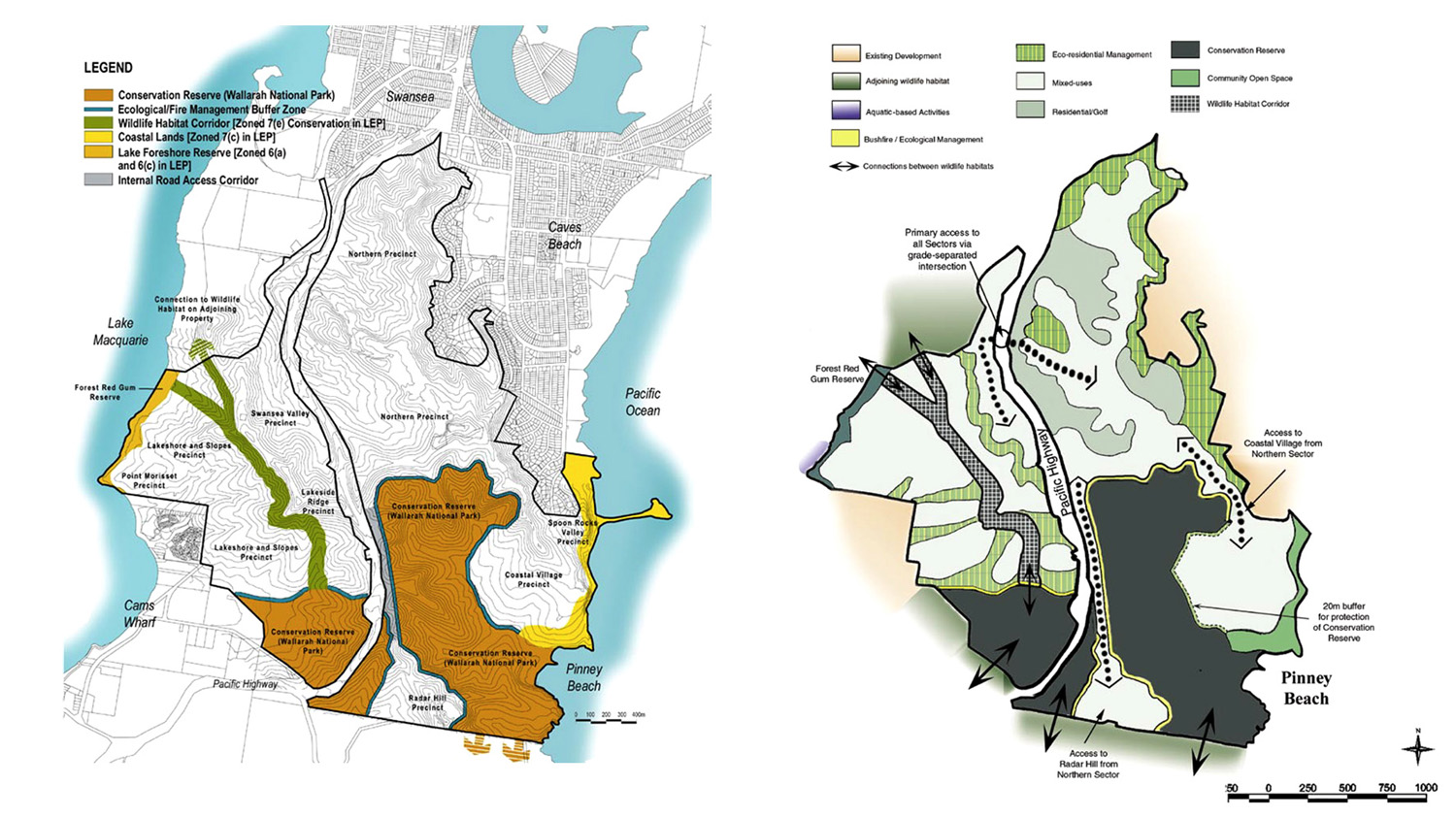
The Local Environmental Study involved a comprehensive analysis of the site to determine the suitability for a range of residential types. A set of clearly defined ecological, visual and geophysical criteria were developed in carrying out the analysis process. By applying the assessment criteria areas of high conservation value were identified that were considered to be unsuitable for any form of residential development. Other areas were identified that were determined to be suitable for special types of residential development subject to stringent planning controls.
Results of the site suitability assessment were incorporated in a Conservation and Land Use Management Plan (CLUMP), which provided the
supporting document for a new LEP for the site. The core ecological values of the site are incorporated in a 200 hectare Conservation Reserve that was transferred to State Government and dedicated as North Wallarah National Park. A system of wildlife corridors connects the Reserve to other habitat areas of regional significance. Scenic resources associated with the visually prominent ridges and coastline are protected under the new LEP, which provides for a range of development types that respond to the varied site conditions.
Former quarry areas were designated for compact residential development while open woodland areas were assessed as suitable for special residential development that involved detailed site analysis to determine suitable
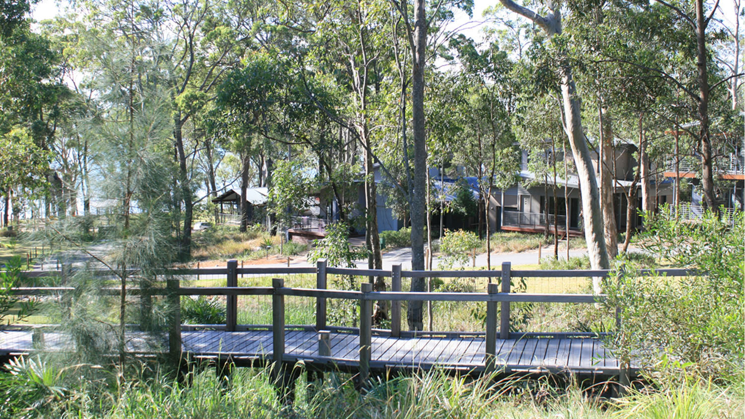
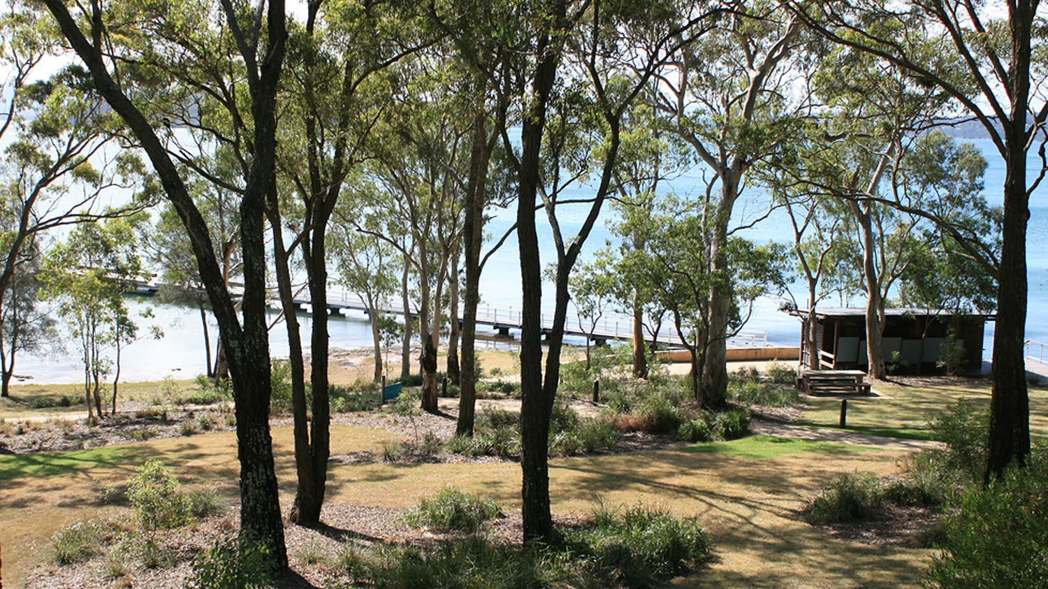
building footprints to minimise loss of trees. Approximately 10,000 trees were surveyed and assessed as part of the detailed site planning process. Community facilities were developed that includes a cafe/restaurant together with a new public jetty and open space recreation on the foreshore of Lake Macquarie. A walking track was constructed to connect the lake foreshore to the coastline, crossing the highway via a new pedestrian bridge.