
The coastal scenic resources of NSW are widely recognised as a major tourist attraction and state asset. At the same time urban development pressure threatens the high quality scenic values that attract people to the area.
In response the Department of Infrastructure Planning and Natural Resources (DIPNR) engaged URS to develop a methodology that could be applied to identify and assess the scenic values of the NSW coast. As Principal Landscape Architect at URS, Noel Corkery managed the coastal visual assessment project, working in collaboration with JVP Visual Planning and Design.
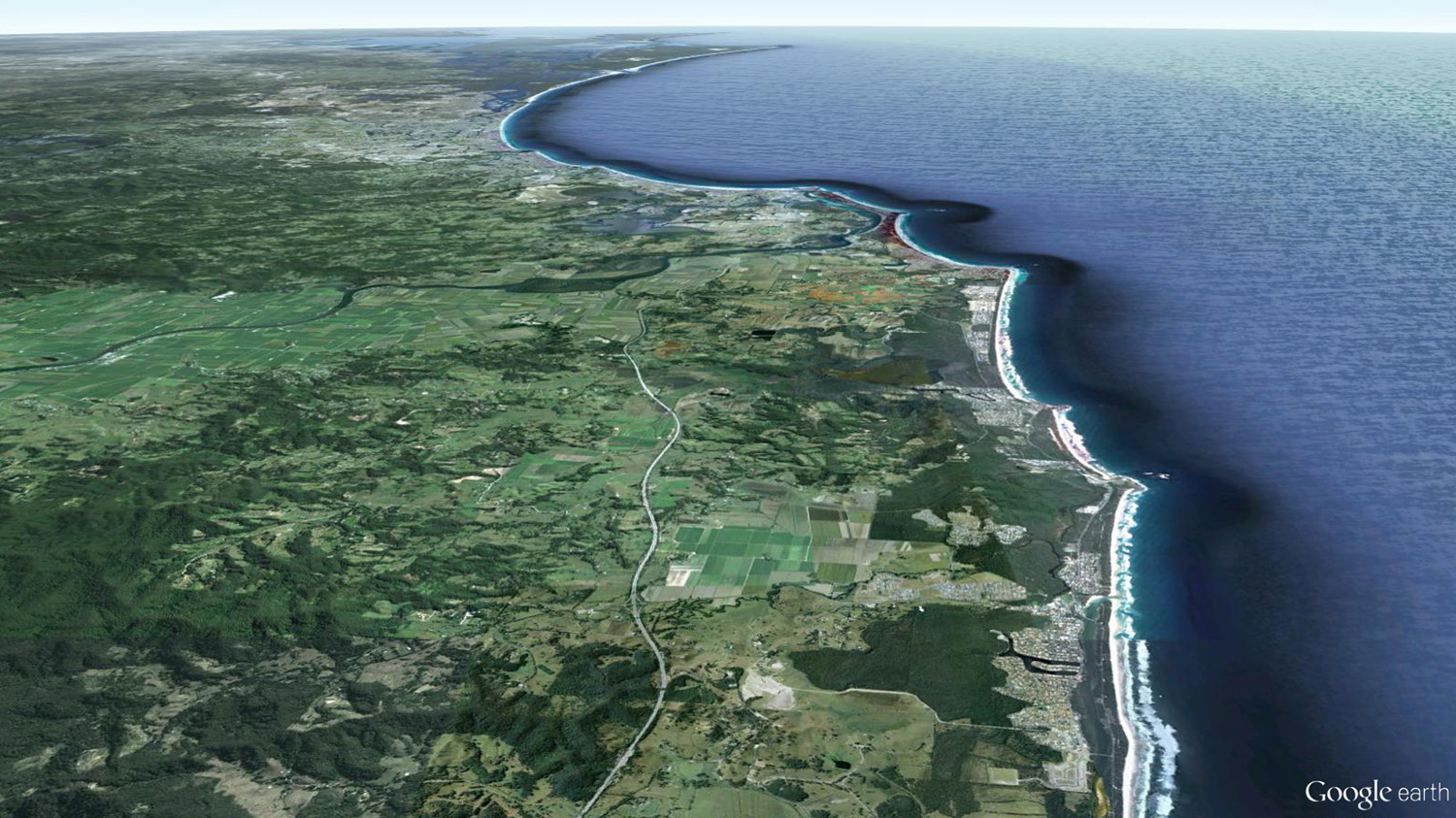
Outcomes of the visual assessment formed a major component of the Comprehensive Coastal Assessment (CCA) prepared by DIPNR. The methodology was also applied in a pilot project that covered a section of the NSW north coast within the Tweed Council local government area.
Client: Department of Intrastructure Planning & Natural Resources (DIPNR)
Location: NSW Coast Australia
PROJECT DESRIPTION
The Comprehensive Coastal Assessment prepared by DIPNR generated a data base and planning framework for planning decisions. It involved mapping and assessment of a wide range of physical attributes of the coastal zone including geology, soils, ecological and aquatic values. The Visual Resource assessment, which included the physical and socio-economic values, formed a significant component of the CCA. As principal landscape architect at URS Noel Corkery was responsible for coordination of the assessment
The overall objective of the Visual Assessment was to provide a methodology to characterise, assess and document the visual resources of the NSW coast to assist in the protection and management of those resources.
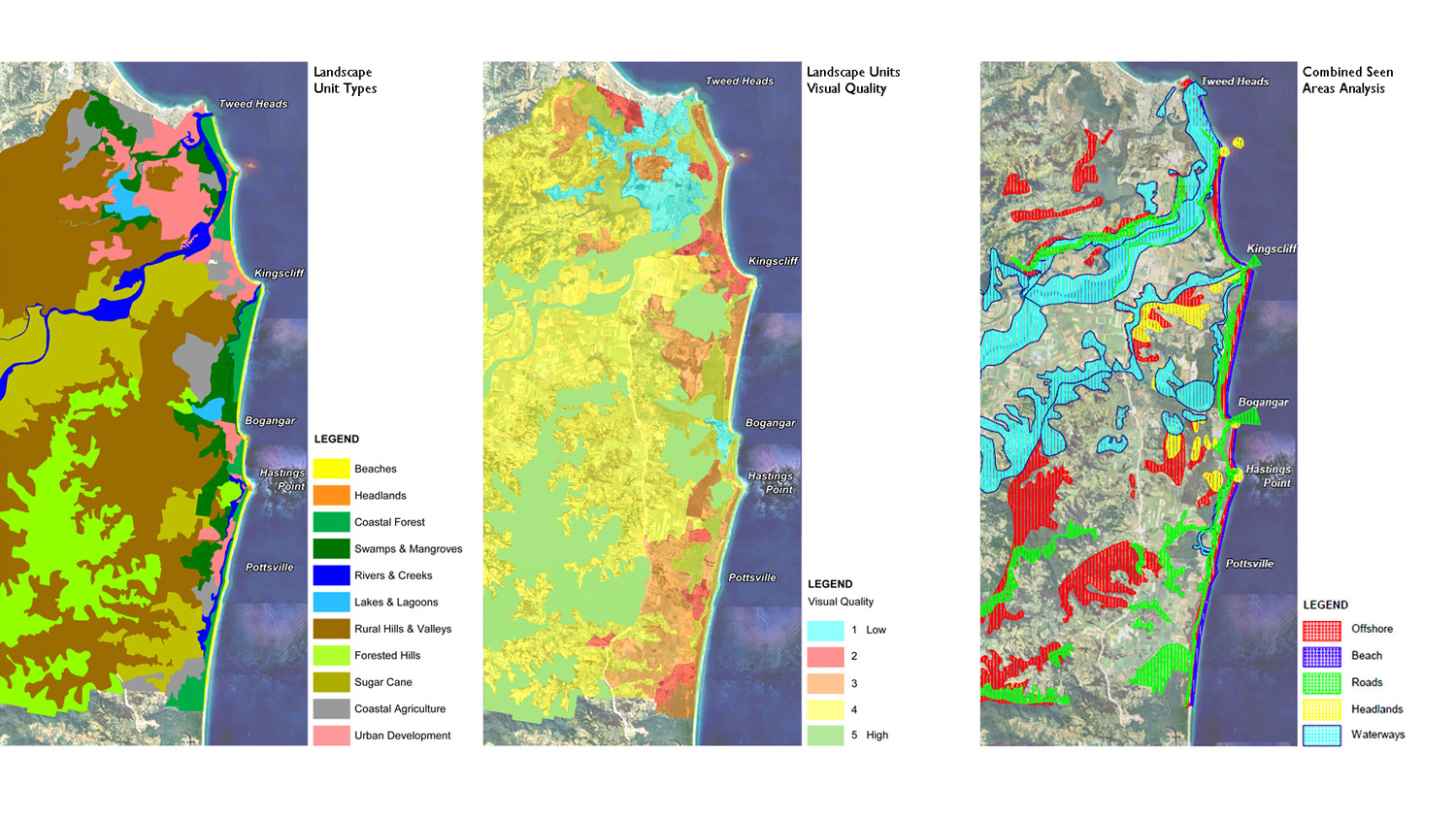
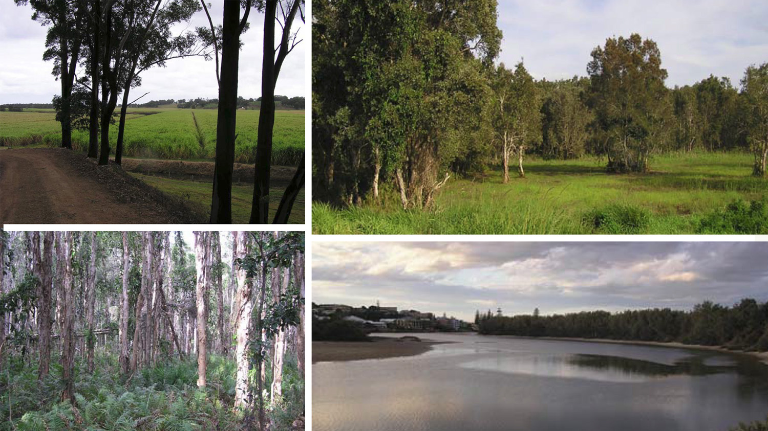
A Pilot Project was undertaken for a 40 kilometre section of coast that forms the eastern boundary of Tweed Council. Extensive GIS mapping and analysis of data sets aimed to:
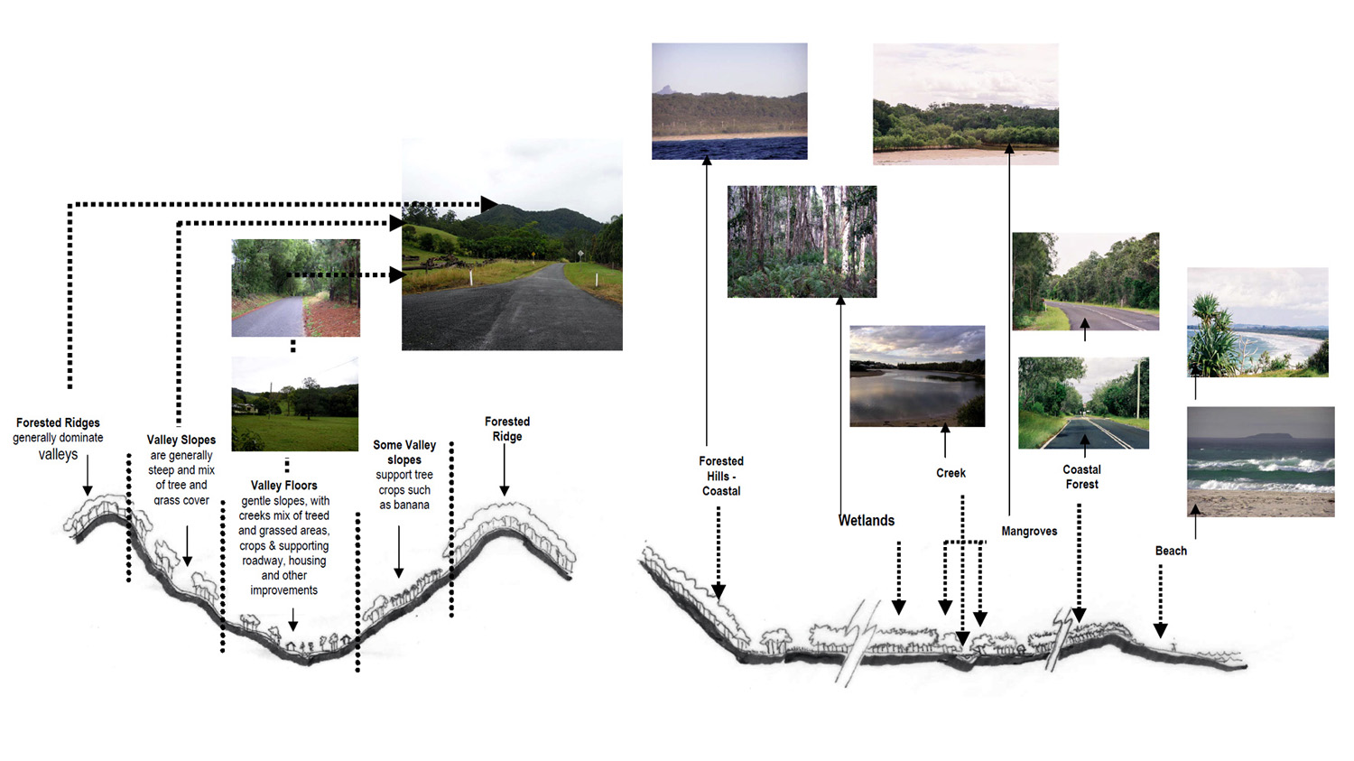
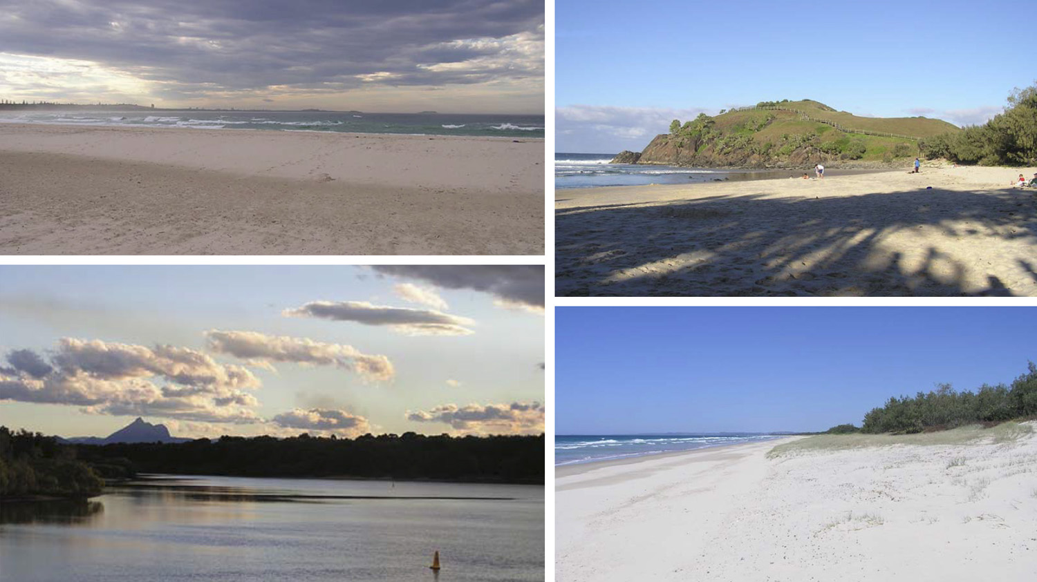
Establish the extent of the coastal landscape
Define the visual character of distinct landscape components
Define the extent of visual catchment or areas seen from coastal land area, beaches and off shore
Assess visual quality of landscape units
Identify ways to manage the visual qualities of the coastal landscape at a regional level
Create a framework for more detailed visual assessment, planning and design at a local level
Provide a basis for managing coastal visual resources in a coordinated way with other values such as ecological and recreation values
Assist Council to maintain and manage those coastal scenic values.
Workshops were held that involved Tweed Council Officers and presentations were made to the Project Steering Committee. Guidelines for the management of the visual resources in the Tweed area were then presented in the Project Report prepared by DIPNR.